Intro
When you cross sorghum in the field, you pick a female plant, bag it and spray-paint it. Then you walk off to collect pollen from five different males before coming back to her. Females are far outnumbered by males, so the walk back can be a long one.
Plotpin started as a prototype I put together in about two hours to get me back to those females. In September I rebuilt it so that anyone who marks points in a field can use it. That means breeders, but also pathologists, soil and insect crews and plot technicians.
GPS won’t find a plant
In an open field, a good phone’s GPS lands within roughly 1 to 4 m. Sorghum rows are 30 inches apart, so that circle covers several plants. The error when you tag a plant and the error when you come back can also add up.
So Plotpin walks you into a circle of about 3 m around the right plant. The paint, the bag, a QR label and the photo you took when tagging do the last few metres.
To make that circle as tight as it can be, tagging takes a few seconds. While you hold still, the app keeps taking readings and averages them, giving the more accurate ones more weight. Each tag shows how accurate it was and how many readings went into it. Pair an RTK receiver and the app uses that instead, recording accuracy in centimetres.
Walking back
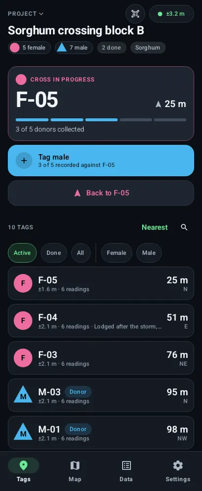
Navigate shows an arrow and the distance. The phone vibrates in pulses that come faster as you get closer, so you can walk without staring at the screen. Once you’re inside the combined uncertainty, it tells you you’ve arrived and shows the photo.
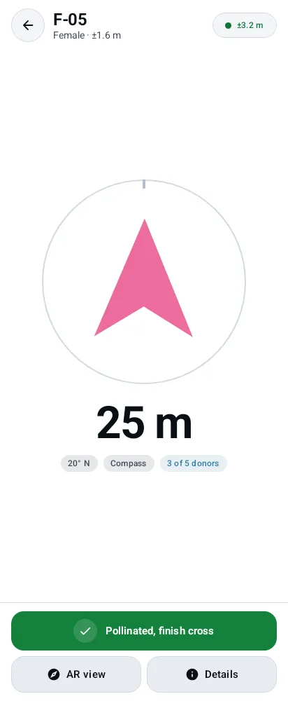 On the way
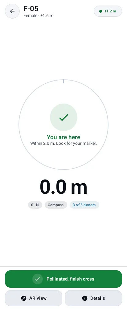 Arrived
Phone compasses are often 10 to 20 degrees out. At 60 m, being 15 degrees out puts you about 15 m from the plant. Plotpin corrects for magnetic declination. It also learns the compass’s own error by comparing it with the direction GPS says you’re actually walking.
There’s an AR view as well, which draws the tags over the camera image. The arrow is the default, though. The camera only runs when you ask for it.
Crosses
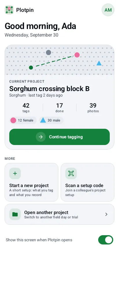
For crossing, a tag is either a parent or a donor. Tag a female and a cross opens on her. Every male you tag while it’s open is recorded against her. The screen counts them towards the number of donors you’re aiming for.
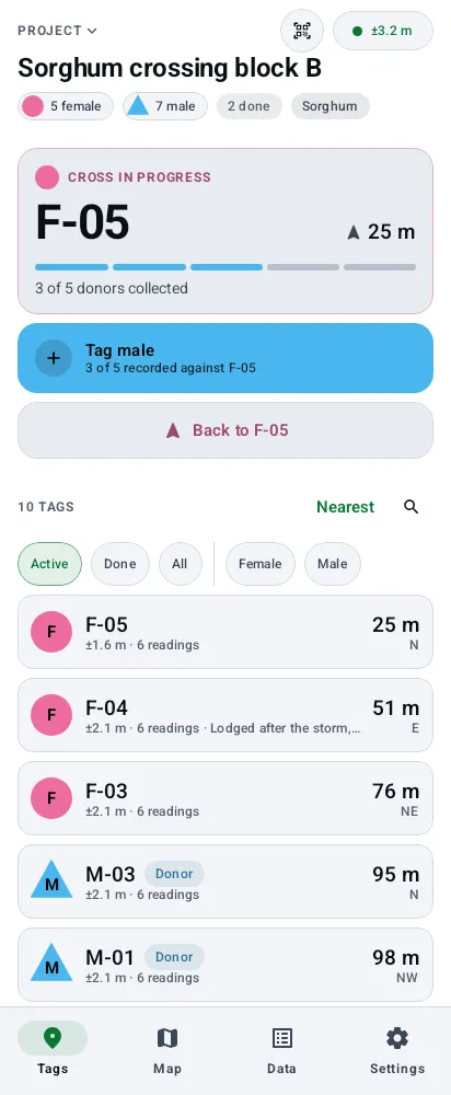 Tags
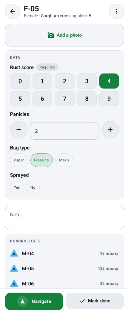 One parent
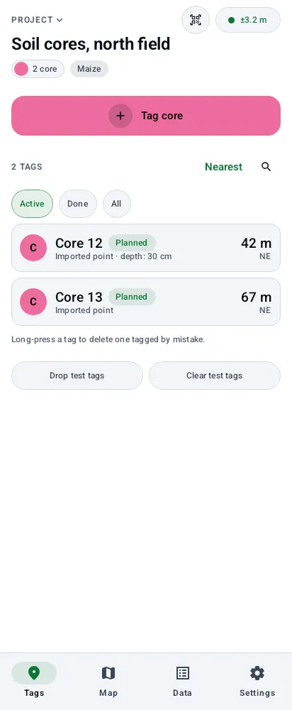
Marking a plant done and deleting it are different on purpose. Done means the work happened, so the tag leaves the active list but stays in the record and in every export. Delete is for a tag made by mistake. It asks first, then gives you a few seconds to undo.
A map with no signal
The map is a north-up drawing made from the coordinates themselves. There are no map tiles and nothing to download, so it works in the middle of a field with no signal.
Each tag carries a faint ring for its accuracy, so the map never looks more precise than the readings were. Dashed lines join each donor to its parent, so you can see each cross at a glance. You’re the green dot, with a line showing which way you’re facing.
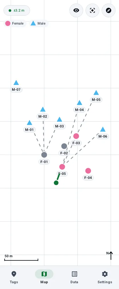 Light
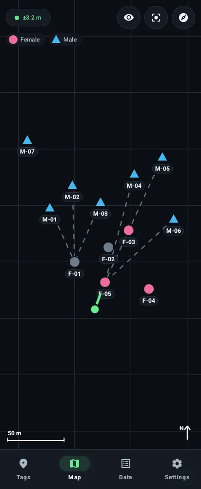 Dark
Other kinds of project
Sorghum crossing is now just one preset. When you start a project, a short wizard asks what you’re tagging: parents and donors, one kind of tag, or two kinds you need to tell apart, such as healthy and diseased plants. Each kind gets a name, a letter for its labels and a marker shape as well as a colour, so colour is never the only thing that tells two kinds apart.
Each kind can also carry fields: a score from 0 to 9, a count, a measurement with units, a pick list, yes or no, or a note. Every field becomes a column in the export. A lab lead can set up a project once and share the setup as a file or a QR code, with no data in it.
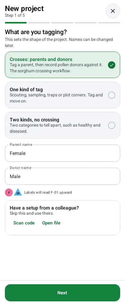 What you tag
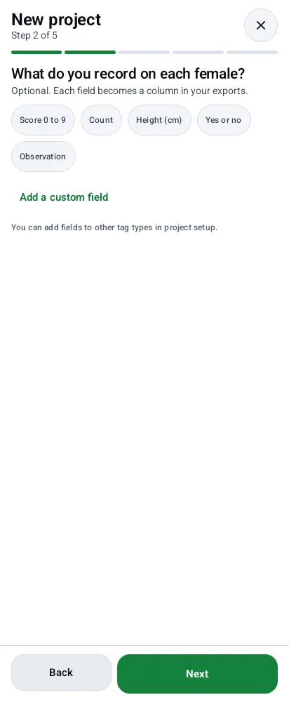 What you record
 Soil cores
Getting data out
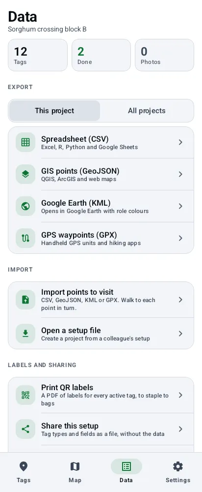
Exports go out through the phone’s share sheet as CSV, GeoJSON, KML or GPX, so they open in Excel or R, in QGIS, in Google Earth or on a handheld GPS. All four are built from the same table, so they always agree. These are the columns, followed by one for each field:
project,crop,field,plot,label,role,status,source,latitude,longitude,accuracy_m,altitude_m,
fix_count,collector,created,completed,cross_parent,donor_count,note,photo
It reads the same formats back in as planned points to walk to. QR labels print as a PDF sheet, three across and seven down, on Letter or A4 depending on the phone’s region. Scanning one opens that tag.
Backups are a single file with every tag and photo. Restoring one merges instead of replacing it: tags already on the phone stay, newer edits win and deletions carry across. A crew can use this to combine its phones at the end of the day.
 Data
Made for the field
A few details come from actually using it out there:
- The volume key tags a plant, which works with gloves on.
- The automatic theme uses the light sensor to switch to light in bright sun and back to dark in shade.
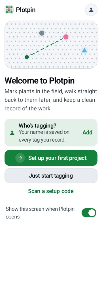
- Text holds up at large font sizes. Button labels shrink before they get cut off, and rows stack when they don’t fit.
- Location updates once a second while you navigate or tag. Otherwise it slows down. The camera only starts on the screens that need it. Closing the app stops everything.
 160% text
 Settings
 Dark
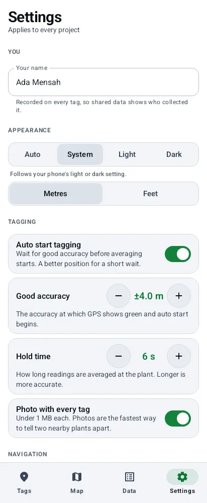
Every screen except the camera ones is rendered in tests, in light, in dark and at 160% text on a small phone. A test fails if one changes by accident. The screenshots on this page come from those tests.
What’s next
It’s called Plotpin now. It was PlantTag until the end of September, but a plant-care app on the Play Store already had a name too close to it.
A Play Store release is the plan. Live sharing between phones isn’t built yet. The idea is peer to peer over Nearby Connections, which works with no signal at all. The limit to design around is range, about 100 m, so two people at opposite ends of a big plot won’t see each other’s tags until they’re closer. Letting someone claim a tag for a few minutes would stop two people walking to the same plant.